Chardham Route update Map
Chardham Route Map – A Complete Guide for Pilgrims
Introduction to Chardham Yatra
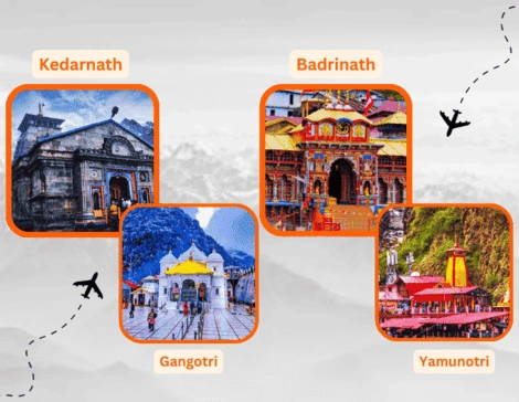
The Char Dham Yatra in Uttarakhand is a soul-stirring pilgrimage that takes travelers through the divine circuit of Yamunotri, Gangotri, Kedarnath, and Badrinath. Nestled in the pristine lap of the Garhwal Himalayas, these four holy shrines are not just destinations but profound spiritual experiences, drawing countless devotees seeking blessings and inner peace. Each of these destinations holds deep spiritual significance, and together they form the Chardham circuit, attracting lakhs of devotees every year. Understanding the Chardham Route Map is essential for planning a smooth and well-organized journey.
Starting Point of the Yatra
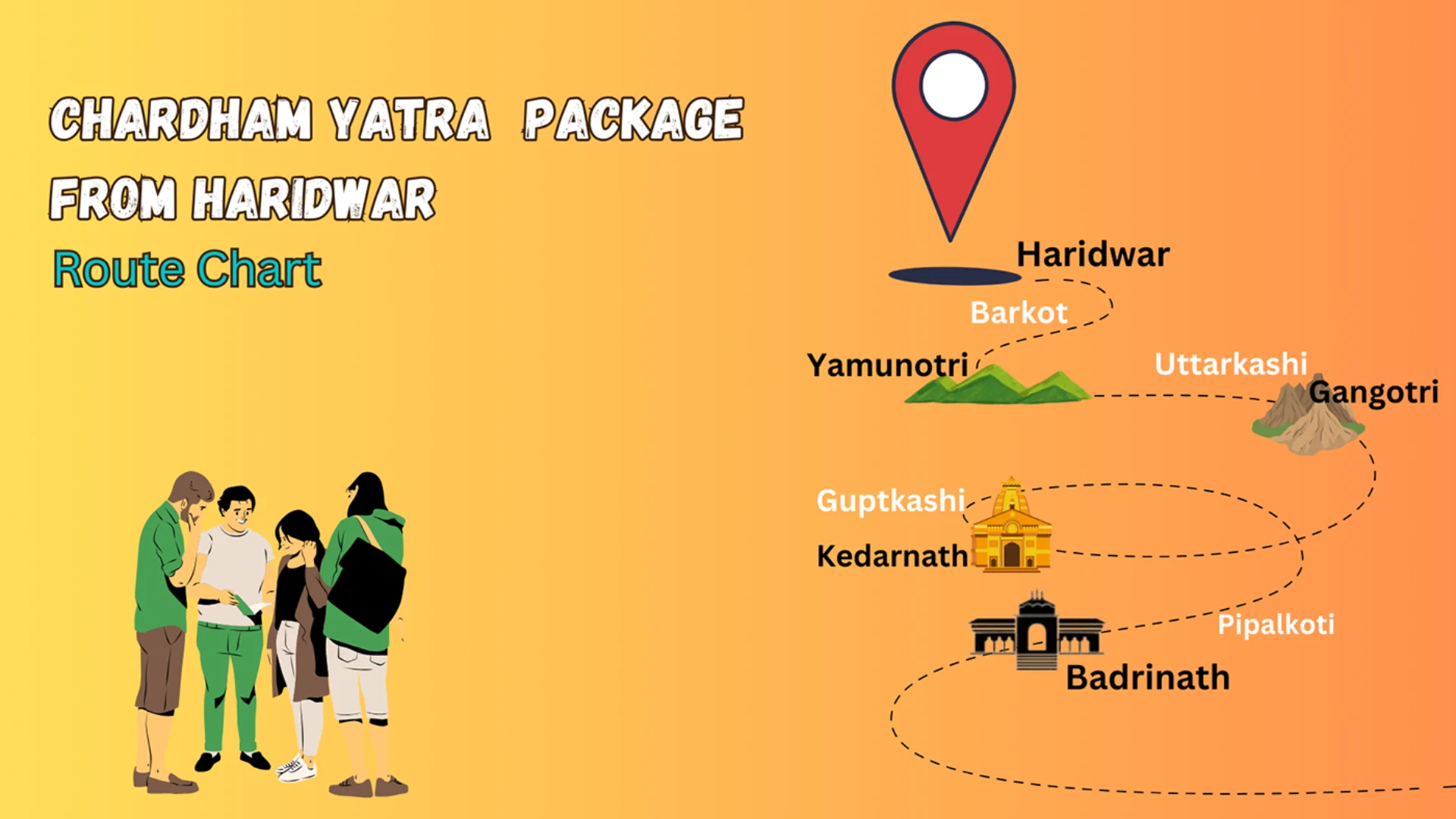
Traditionally, the Chardham Yatra begins from Haridwar, Rishikesh, or Dehradun, which serve as the main gateways. Most pilgrims start from Haridwar, known as the spiritual entry point of Uttarakhand. From here, road journeys are the most common mode of travel, though helicopter services are also available for faster darshan.
Route Sequence of Chardham Yatra
The order of visiting the shrines is predetermined to uphold the sacred tradition. Pilgrims must start from west to east:
- Yamunotri – The source of River Yamuna.
- Gangotri – The origin of River Ganga.
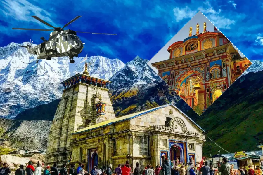
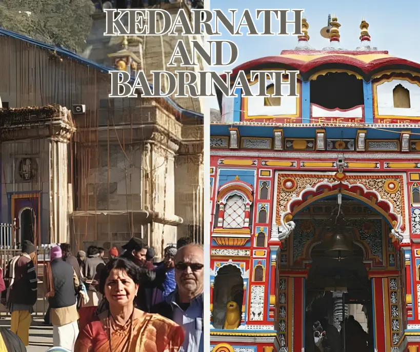
- Kedarnath – The sacred temple of Lord Shiva.
- Badrinath – The holy abode of Lord Vishnu.
Following this order ensures the yatra is completed in a spiritually fulfilling way.
Chardham Route Map in Detail
Haridwar/Rishikesh to Yamunotri
- Distance: Around 220 km by road to Janki Chatti.
- Pilgrims begin their 6 km trek from Janki Chatti to arrive at the sacred Yamunotri Temple.
- Key stops: Barkot and Hanuman Chatti.
Yamunotri to Gangotri
- Distance: Approximately 230 km by road.
- The path passes through Uttarkashi and Harsil, offering travelers spectacular vistas of the Himalayas.
- After a brief walk from the road head, pilgrims arrive at the sacred Gangotri Temple.
Gangotri to Kedarnath
- Distance: Around 400 km by road up to Gaurikund.
- From Gaurikund, a 16 km trek leads to Kedarnath Temple.
- Alternatively, pony, palki, and helicopter services are available.
Kedarnath to Badrinath
- Distance: About 230 km by road via Rudraprayag and Joshimath.
- The journey offers mesmerizing views of rivers, valleys, and mountains.
- Badrinath Temple marks the final stop for pilgrims on the Chardham Yatra.
Major Confluences on the Route
As pilgrims travel along the Chardham route, they encounter the five holy confluences known as the Panch Prayag:
- Devprayag (Bhagirathi and Alaknanda)
- Rudraprayag (Alaknanda and Mandakini)
- Karnaprayag (Alaknanda and Pindar)
- Nandprayag (Alaknanda and Nandakini)
- Vishnuprayag (Alaknanda and Dhauliganga)
These confluences enhance the spiritual journey, making the route more divine.
Transportation and Travel Tips
- By Road: Most pilgrims travel by buses, taxis, or private cars.
- By Rail: Haridwar, Rishikesh, and Dehradun are the nearest railway stations.
- By Air: Jolly Grant Airport (Dehradun) connects with major cities.
- Helicopter Services: Available from Dehradun, Phata, Guptkashi, and other points for faster travel.
Conclusion
The Chardham Route Map not only guides devotees through the sacred shrines but also unfolds the natural beauty and cultural richness of Uttarakhand. From the sacred sources of holy rivers to the tranquil temples set in the Himalayas, the journey combines both spirituality and adventure.Whether by road or helicopter, completing the Chardham Yatra is considered a path to ultimate salvation and inner peace